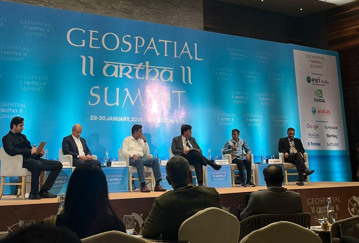
The session held at the Geospatial Artha Summit, 2024 titled “Frontier Technologies: Expanding Market Value Chain of Indian Geospatial Industry,” proved to be a crucible of innovative ideas and insights and featured a panel of industry experts who delved deep into how frontier technologies are reshaping the landscape of the Indian geospatial industry.
The Intersection of Geospatial and Frontier Technologies
India’s geospatial economy has been projected to cross Rs 63,000 crore by 2025, growing at a rate of 12.8%, employing more than 10 lakh people mainly through geospatial start-ups. Geospatial technology involves the use of tools such as Geographic Information Systems (GIS), satellite imagery, and GPS to collect, analyse, and interpret location-based data.
In India, Geospatial Technology has gained momentum due to the government’s support through initiatives like the National Geospatial Policy, aiming to make geospatial information more accessible to different sectors.
Aditya Chaturvedi, Executive Editor, Geospatial World set the stage by describing our current era as one of ‘creative destruction,’ characterized by rapid transformations and unexpected disruptions.
He said, “We inhabit an era of ‘creative destruction’, unanticipated disruptions, and fast-paced transformations, leading to newer alignments and synergies between geospatial and frontier technologies.”
Frontier technologies in this era includes advanced technologies like AI, IoT, big data analytics, and blockchain. These technologies, when integrated with geospatial tools, enhance the capacity for data processing, real-time analysis, and predictive modelling.
Vinay Simha, CEO of Skyserve, explored the impact of technologies like AI, IoT, cloud computing, digital twins, and the metaverse on geospatial operations.
These tools, he argued, are revolutionizing the management, distribution, and dissemination of geospatial data. A particular emphasis was placed on the use of AI and Machine Learning (ML) for driving effective actions and decisions.
Dr. Vishnu Chandra from the Ministry of Panchayati Raj discussed the evolution of geospatial ecosystems since the early 1990s. His talk focused on how technologies such as geoAI, 5G, and edge computing are being seamlessly integrated into geospatial workflows. This integration is crucial for addressing various challenges, ranging from data capture to regulatory aspects.
Driving Economic Value and Sustainable Computing
The session also shed light on the economic aspects of geospatial technologies. Sustainable computing in geospatial technologies involves the design and use of computing resources in an environmentally friendly and resource-efficient manner focusing on reducing the environmental impact of digital technologies, including energy consumption, electronic waste, and carbon footprint.
Adopting sustainable computing practices can lead to significant cost savings for businesses, primarily through reduced energy consumption and lower operational costs. It also opens new markets and opportunities for innovation in green technology sectors, creating jobs and stimulating economic growth.
Vishal Dhupar, Managing Director at NVIDIA, emphasized Earth’s economic value and the urgent need for sustainable computing practices. He underlined the importance of accelerating computing processes to better understand and address complex global issues.
Dhupar highlighted AI’s role in making computing more accessible and efficient, presenting India with an opportunity to become the “back office of the world” in this arena.
AI and ML algorithms can be used to optimize data centre operations, one of the most significant energy consumers in the IT industry. These algorithms can predict and manage workloads, thereby reducing unnecessary energy consumption.
For instance, Google uses DeepMind’s AI to optimize energy usage in its data centres, achieving significant reductions in cooling energy usage.
Pavan Kumar, from Altair Engineering, shared insights on how to leverage AI and ML in mechanical simulation computing. He stressed the importance of learning from proven data, particularly in the geospatial sector where trends are increasingly pointing towards the cross-integration of IoT and geospatial data.
The key lies in harnessing these technologies not just for the sake of innovation but for driving effective, sustainable solutions to real-world challenges.
The convergence of these technologies also presents unique challenges, particularly in terms of data management, privacy, and regulatory compliance.

Wanda Parisien is a computing expert who navigates the vast landscape of hardware and software. With a focus on computer technology, software development, and industry trends, Wanda delivers informative content, tutorials, and analyses to keep readers updated on the latest in the world of computing.


